
Melbourne's development by tram: the 59

In this series, we'll progressively work our way clockwise around Melbourne's tram network, taking a look at the development pipeline that lies adjacent to each tram route as well as provide some facts and figures about the tram routes along the way.
Given all tram routes, except two, eventually bunch up and run through CBD streets, the Melbourne's development by tram series won't include projects in City of Melbourne or Port Phillip.
With the exception of the Flemington Road, Elizabeth Street and city terminus segments, the 59 Airport West - Flinders Street Station, City (Elizabeth Street) tram line is wholly contained within the City of Moonee Valley.
Upon exiting the City of Melbourne on Flemington Road, the 59 travels along Mount Alexander Road through Travancore, Ascot Vale and Moonee Ponds and after the Moonee Ponds Junction, the route diverges along Pascoe Vale Road and Fletcher Street in Essendon and then rejoins Mount Alexander Road at Essendon Station.
The route then continues up Mount Alexander Road through Essendon North, turns westward along Keilor Road through Niddrie and then northwards to run in its own right of way beside the Tullamarine Freeway and Essendon Fields to the terminus near Airport West shopping centre.
The numbers
| Aspect | Number of projects | Number of dwellings |
|---|---|---|
| Residential projects: Planning Assessment | 10 | 1,246 |
| Residential projects: Approved | 10 | 509 |
| Residential projects: Registration and Sales | 10 | 477 |
| Residential projects: Under Construction | 8 | 969 |
| Commercial projects | 1 | N/A |
| Hotel projects | 1 | N/A |
| TOTAL | 40 | 3,201 |
*Residential projects includes mixed use projects.


| tram route 59 | Further information |
|---|---|
| Timetabled weekday peak frequency | 6-7 minutes (~10 trams per hour) |
| Timetabled weekday off-peak frequency | 8 minutes (7-8 trams per hour) |
| Timetabled weekend daytime frequency | 12 minutes (5 trams per hour) |
| Timetabled night-time frequency | 20 minutes (3 trams per hour); 30 minutes/2 trams per hour (Sunday nights) |
| Raised-platform stops? | Limited outside City of Melbourne. New Moonee Ponds junction stop has raised platforms. |
| Where do the trams go to sleep? | Essendon Depot (Mt. Alexander Road, Ascot Vale) |
| Primary tram class that operates on the route. | B2 (high-floor, articulated) - details, see vicsig.net |
| Annual patronage and rank | 10,200,000 trips annually, Melbourne's 6th busiest tram route. Source |
Mount Alexander Road (South)
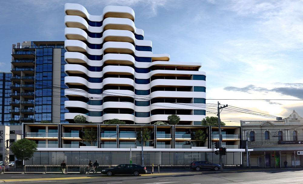
With the exception of 484-486 Mt Alexander Road, all the current development along the southern section of Mt. Alexander Road where the 59 tram route runs is concentrated in the Moonee Ponds Activities District. From Travancore, at the boundary with the City of Melbourne, to Moonee Ponds junction, Mt Alexander Road is predominantly zoned B2Z (C1Z) on Moonee Valley's planning scheme.
Moonee Ponds junction is a major transit hub with the terminus of the 82 Moonee Ponds: Footscray tram and 10+ bus routes all contained within the Mt. Alexander Road median. The Craigieburn train line forms the western boundary of the Moonee Ponds Activities District and between it and Mt Alexander Road there are no less than 16 projects.
Pascoe Vale Road and Fletcher Street
In this short deviation of the 59 route, Pascoe Vale Road swaps between B2Z and R1Z zoning according to the most recent maps available for the City of Moonee Valley planning scheme. Fletcher Street in Essendon is zoned R1Z except for a Public Use Zone plot on the corner of Hoddle Street.
As such, only two projects on the Urban.com.au Project Database existing in this section, on Pascoe Vale Road.
Mount Alexander Road (North)
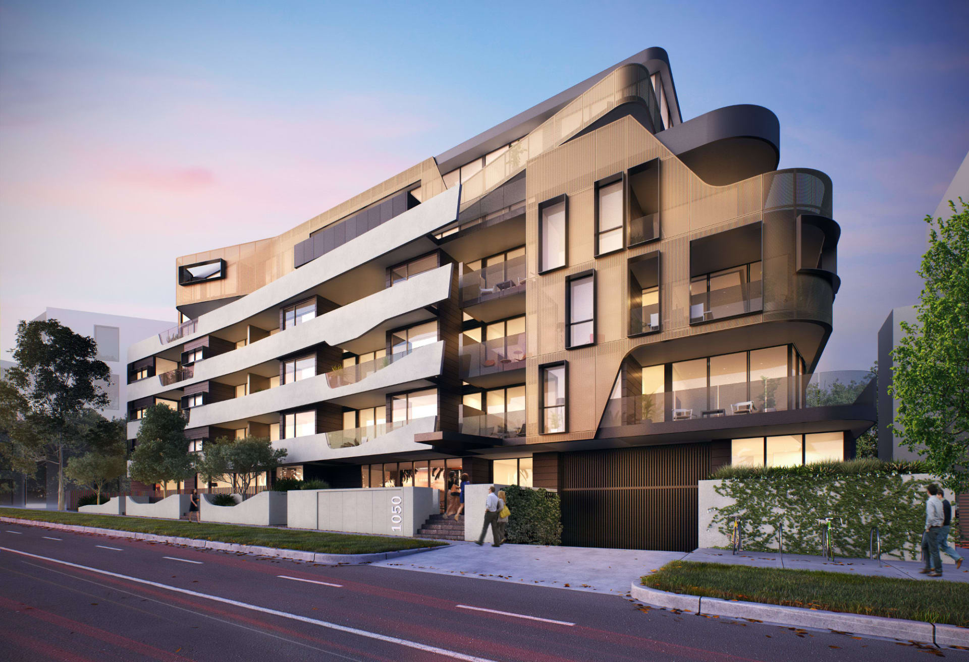
Within Essendon, at the junction of Fletcher Street and Mt. Alexander Road, there are 7 projects nestled either side of Essendon train station. Excluding a small section of R1Z zoned land on the northern side of the Craigieburn train line bridge, Mt. Alexander Road like in the south of the city of Moonee Valley is zoned B1Z (C1Z).
Keilor Road
Keilor Road has seen some of the greatest changes in recent years. No longer dominated by car sales yards (although some still do exist), much of the old Calder Highway route has been redeveloped with the street showing a penchant for 4-6 level buildings.
Much like Mt. Alexander Road, Keilor Road is dominated by the mixed-use friendly B1Z and B2Z (C1Z) zones and outside of recently completed projects, there are 5 projects in this corridor, with another at the Mt Alexander Road/Keilor Road junction.

Matthews Ave
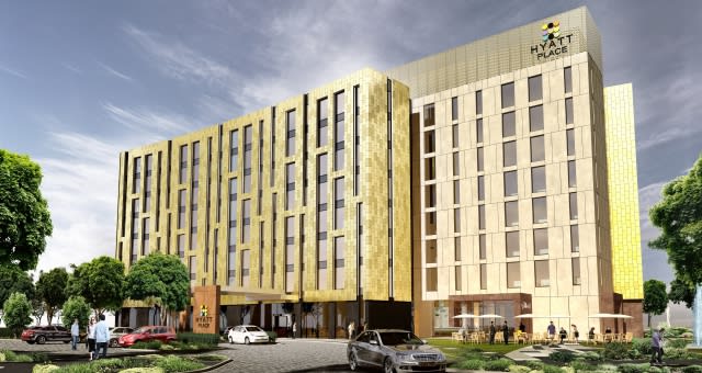
The tram tracks don't run in Matthews Ave, but in a dedicated right of way between Matthews Ave and the Tullamarine Freeway. To the east is Essendon Fields and to the west is the semi-industrial/commercial area of Airport West and these two areas no stranger to new development.
Alfa Apartments, located almost at the end of the 59 tram line, is under construction and Essendon Fields is seeing hotel and commercial development.
Future directions
The bulk of the new development on the 59 tram route is occurring either in Moonee Ponds and Essendon or the northern end of the route with only a single project on Mt. Alexander Road south of Moonee Ponds, which some might expect, given the proximity to the centre of Melbourne, would see the highest levels of new proposals.
The 59 route sees a very good level of service and is well connected in the nodes that matter: at Moonee Ponds and its elaborate bus terminus and at Essendon with the Craigieburn train line.
APAC, the operator of Melbourne Airport, has significant plans to develop the land that now sits adjacent to the new Airport Drive extension yet there has not been any serious proposals to service this employment precinct that will grow over time.
If the 59 tram were to be extended over/under the Western Ring Road to then run down Sharps Road and then turn northward on Airport Drive and run all the way to the Tullamarine Airport terminals, locals who are not serviced by the Skybus service (and those who will also miss out on service if the Airport Rail Link eventually runs along the Albion corridor) would have a fast and frequent service to the airport and the growing employment precinct to the south of the airport.
Navigation
- Clockwise: the 55, Domain Interchange - West Coburg (second in this series)