
Turning the East West Road Link into a rail link
The words East West Link are now synonymous with the lacklustre freeway project whose first stage was set to connect the Eastern Freeway with the Tullamarine Freeway. It took a state election and new government on Spring Street to expose the project as one propped up by shaky economic benefits.
The new State Government has cancelled the contracts for the East West Road Link and conducted a blitzkrieg of announcements relating to public transport and its flagship level-crossing removal program. The East West Road Link in its previous form may be dead, but it certainly won't be buried if the road and freight lobbyists decide to ark up once more.
Likewise in the planning sphere Spring Street is entering into a new round of community consultation on Fishermans Bend - the new Government has even expanded the area to include all the land which lies to the north of the West Gate Freeway.
By itself Fishermans Bend Urban Renewal Area is going to dominate the urban development scene Australia for decades to come. Throw in E-Gate, Arden-Macaulay (which is sure to be back on the radar now thanks to the Melbourne Metro Rail project) and former industrial areas in South Kensington and the picture becomes a lot clearer - both Labor and Liberal parties and their respective planning policies and flagship projects have consistently shown a preference for ongoing redevelopment of central Melbourne and the pipeline is now completely mind-boggling.
As I wrote last month, the Fishermans Bend review should not just focus on previously aired concerns about building heights and community facilities, but it should focus heavily on how people will access the precinct; not just from a CBD-centric point of view but from the West as well.
Doncaster and Fishermans Bend: two birds with one stone?
Despite the East West Road Link project being dead, the amount of traffic on the road which spews into the inner-north is anything but dead.
The end concept for Doncaster which came about as a result of Ballieu/Napthine Government's Doncaster Rail study was to have a branch line built off the Clifton Hill line which would run down the median of the Eastern Freeway and have it stop short at the Doncaster Park and Ride, not the centre of Doncaster on top of the hill.
The major caveat, as a result from the study, was that a new tunnel would need to be built from Clifton Hill to Southern Cross and eventually Fishermans bend in order to divert one of the existing rail lines which run in the Clifton Hill corridor so a paltry 7 trains an hour could run on the future Doncaster Line.
Most interestingly the report said that only 2% of the project patronage on the line would come from people who are currently travelling by private vehicle.
It's this area I'm most interested in because the preferred alignment from the study stopped short of the major Doncaster activities centre and likewise didn't serve any new areas in the inner north, the area in which the original East West Link Needs Assessment (EWLNA) study said much of the Eastern Freeway's traffic is destined for.


As discussed last week, expanding our rail network to a specification that allows any existing rolling stock to run on new lines is an incredibly expensive job and we are shooting ourselves in the foot by not looking for cheaper alternatives which can effectively do the same job and better.
The East West Rail Link
Expanding on the Fishermans Bend piece from last month, I've created a new map to illustrate the broad idea of a complete cross-town East West Rail Link utilising infrastructure features that are more favourable when using a vendor's light metro platform.
From West to East, the same principles in Fishermans Bend apply: The Altona and Williamstown branches would be converted and starting at Newport station a new elevated line would lead onto a new Lower Yarra bridge and run on an elevated alignment adjacent to the West Gate Freeway up until Ingles Street in Fishermans Bend. After Ingles Street I've drawn three different tunnel alignments:
- Green: this partially mimics what was released in the PTV's heavy rail plan. One major negative of this kind of alignment is that services which would run in Melbourne Metro Rail tunnel would have poor connectivity to the new East West Rail link (as South Eastern residents would be required to connect in Parkville).
- Blue: Essentially the same as the Yellow tunnel, however it would connect with the South Morang/Hurstbridge lines at Clifton Hill rather than Victoria Park.
- Yellow: the one tunnel I'm focusing on. It has 1 underground station in Fishermans Bend, 1 underground station in Fitzroy and an open-cut station at Victoria Park. 3 interchange stations are located at Southern Cross, CBD South / Flinders Street (under Collins Street) and at Parliament where the station's footprint would be extended all the way to Alexandra parade and St. Vincent's Hospital
Beyond the inner-city tunnels the line would follow the Eastern Freeway median where there's two alternatives - a 4.5km tunnel under Kew and North Balwyn - or continuing along the Eastern Freeway median and then onto an elevated structure between Thompsons Road and Doncaster Road on the northern side of the outbound lanes on the Eastern Freeway.
In both Eastern Freeway scenarios the line would run in the Doncaster Road median on an elevated structure up to Doncaster Hill / Doncaster Shopping Centre.
Blue and yellow circles represent 800m as-the-crow-flies radius around stations.
Times between points - Yellow CBD routing and East Kew-Balwyn North tunnel (Red) routing; assumes an average speed of 40kph.
| Journey | Metro Distance | Metro Time | Current PTV journey time | Notes |
|---|---|---|---|---|
| Longer-distance/commuter trips | ||||
| Doncaster to CBD South / Flinders Street | 16.5km | 25-26 minutes | 34 minutes | Current journey: 907 Smartbus from Doncaster SC to Melbourne Central (Swanston/Lonsdale Streets) |
| Newport to CBD South / Flinders Street | 8.5km | 13-14 minutes | 19 minutes | Current journey: Williamstown/Werribee Line direct to Flinders Street via Footscray |
| Williamstown to CBD South / Flinders Street | 12.1km | 18-19 minutes | 28 minutes | Current journey: Williamstown Line direct to Flinders Street via Footscray |
| Laverton to CBD South / Flinders Street | 20.2km | 30-31 minutes | 29 minutes | Current journey: Werribee Line on the express route bypassing Altona |
| Altona to CBD South / Flinders Street | 15km | 22-23 minutes | 38 minutes | Current journey: Branch line, requires change of train at Newport |
| Short distance/CBD South-Flinders Street connecting journeys | ||||
| CBD South / Flinders Street to Lorimer | 3km | 4-5 minutes | - | Stops at Southern Cross en route. |
| CBD South / Flinders Street to Wirraway | 4km | 6-7 minutes | - | Stops at Southern Cross en route. |
| CBD South / Flinders Street to Todd Road | 5.3km | 8-9 minutes | - | Stops at Southern Cross en route. |
| CBD South / Flinders Street to Fitzroy | 2.6km | 4-5 minutes | 15 minutes | Stops at Parliament en route. Current journey: number 12 tram from Collins Street / Town Hall Stop to Brunswick/Johnston Streets |
| CBD South / Flinders Street to Victoria Park | 4.1km | 6-7 minutes | 18 minutes | Stops at Parliament en route. Current journey: South Morang line (via loop), Parliament to Victoria Park timetabled at 11 minutes |
| Other journey distances / journey times | ||||
| Newport to Victoria Park (traversing the inner city) | 13km | 19-20 minutes | 35-38 minutes | Current journey: Williamstown/Werribee Line and South Morang Line, change of train at Southern Cross. |
| Doncaster to Victoria Park | 12km | 18 minutes | 16 minutes | Current journey: 907 Smart bus from Doncaster SC to Johnston/Hoddle Streets |
| Doncaster to Fitzroy | 13.7km | 20-21 minutes | 34 minutes | Current journey: 207 Bus from Doncaster SC to Johnston/Brunswick Streets (or 907 as above + 10-15 minute walk) |
| End to End: Laverton to Doncaster | 36.7km | 55 minutes | ||
| End to End: Williamstown to Doncaster | 28.6km | 43 minutes |
A comparison with Sydney's North West Rail Link
The first stage of Sydney's Rapid Transit network which will operate independently of Sydney's existing rail network is remarkably similar in scale to what I've outlined above. Excluding the converted lines south of Newport, the "new" section of this line has the following particulars (I've summarised much of the information on the NWRL in the forum):
- Total length: 22.5km versus Sydney's NWRL: 23km.
- Total tunnel length: 12.3km (7.5km through city, 4.8km in Kew/Balwyn) versus NWRL: 15km
- Contract 1 for the NWRL is valued at $1.1 billion and the scope relates to the civil works for the tunnels and associated stations on the new section of the line.
- Total at grade length: 4.6km in the Eastern Freeway median
- Total elevated length: 8km (5.5km from Newport to Lorimer (a large portion of this would be a high bridge across the Lower Yarra), 2.5km from Doncaster Park and Ride to Doncaster Hill/SC) versus NWRL: 4km
- Contract 2 awarded for NWRL was for the 'skytrain' section and the value was $340 million - it is not clear if this also includes a further 4km worth of civil works for track and stations which are in a cutting / at grade.
- 13 stations in total: 8 brand new, 5 interchange with a maintenance and operations centre built at the existing Newport workshops area. NWRL will have 8 new stations and 5 existing stations converted.
- Contract 3 is the largest weighing in at $3.7 billion and it relates to the fit-out of new stations, installation of rail equipment and control systems, procuring vehicles, building a maintenance and operations facility, converting 13km of existing railway for Rapid Transit use as well as operating the services for 15 years.
Yes, we need another study
…just with a different kind of rail technology in mind.
While much of the above talks heavily about the section east of Flinders Street, I am still of the firm view that Fishermans Bend will be the honeypot where benefits are derived. Multiple decades of design and construction activity and jobs as well as tens of billions of dollars worth of end-value redevelopment over that timeframe should warrant a proper rapid transit line through the heart of the precinct from the city to the inner West.
The review of the Fishermans Bend Strategic Framework Plan currently underway should place just as much emphasis on transport needs as traditional community needs and lay the foundation for a new study to be financed in one of the state budgets in this government's first term.
PTV's heavy rail plan released under the previous government alluded to both a second cross-city line and a Doncaster line except they would not have been connected. The findings of the Doncaster Rail study should be looked at once again under a scenario where both original plans are inter-connected with stations located in Fitzroy and Victoria Park (rather than just a connection at Collingwood).
Post Melbourne Metro Rail project, the State Government should be calling time on building new $1 billion-per-kilometre inner city rail lines and look to solutions and rail technology that are cheaper to build and cheaper to operate, just like what the Baird Government in New South Wales is doing.
Modern light metro systems have the capability to compete on capacity against any individual existing (or soon to be upgraded) line in Melbourne and driver-less operation adds all important flexibility to a rail line so that supply can quickly meet demand wherever it is needed.
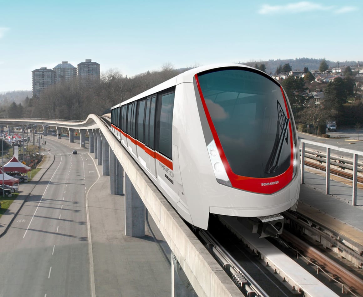
Alstom's Axonis and Bombardier's Innovia Metro turn-key infrastructure + systems + rolling stock rail solutions would provide the same capacity as a conventional rail line but it would be done with smaller stations, shorter trains, more flexibility and most importantly more frequent services.
These systems - thanks to their lower implementation and operational costs - point toward a more positive impact when it comes to assessing costs and benefits. For the sake of Fishermans Bend's long-term viability and development potential, for the sake of lost productivity due to congestion on the West Gate Bridge and Eastern Freeway and for the sake of the people with long commute times to the city from both east and west, we need to get on with it.
Lead image credit: skytrainsforsurrey.org